ancient urban planning
-

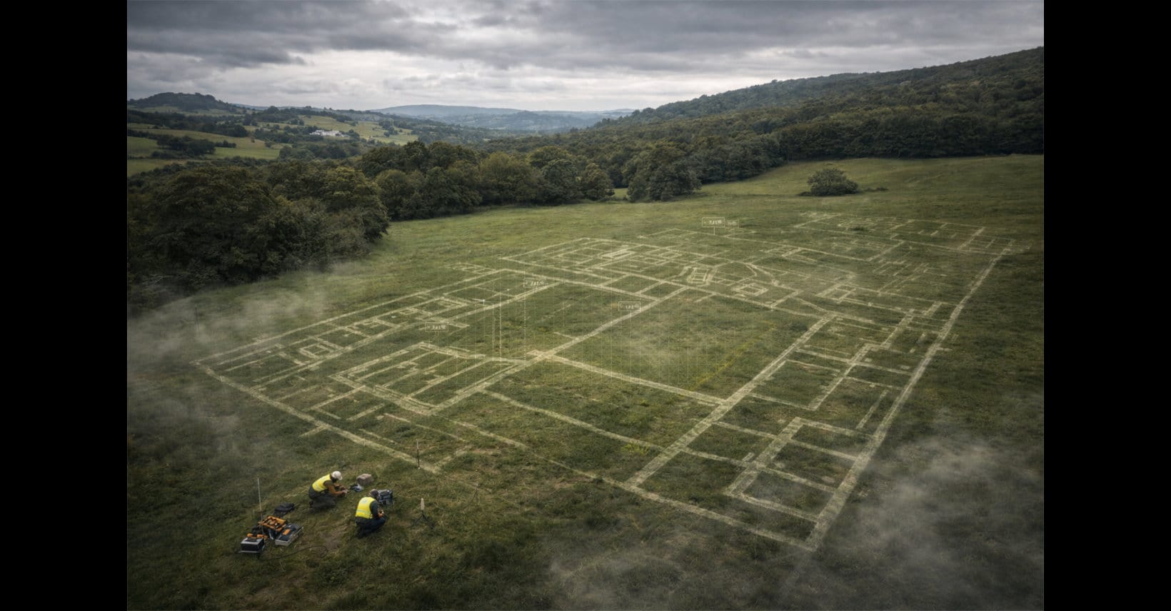
Advanced Drone Mapping Uncovers a Hidden Roman City
Archaeologists in southern Italy have uncovered an unknown ancient Roman city near the Via Appia using drone-based thermal and multispectral imaging. The buried site reveals a grid of streets, forums, and theaters, reshaping ideas about Roman urban planning. The discovery also highlights how advanced sensing technology changes what we can detect and how we interpret…
-
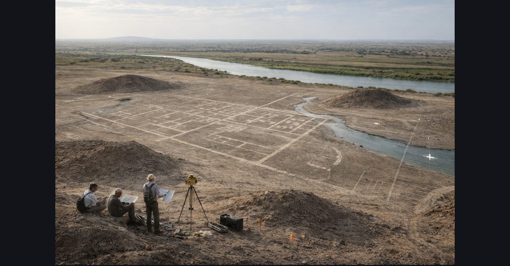
A Forgotten Hellenistic Megacity Re-Emerges From the Desert of Southern Iraq
Archaeologists in southern Iraq are confirming the rediscovery of Alexandria on the Tigris, a long-suspected Hellenistic port city linked to the Seleucid era. Drone surveys, magnetometry, and radar reveal an urban grid, canals, and civic complexes beneath silt and desert, showing how modern imaging can expose buried centers of ancient trade and power.
-
“Port Talbot’s Pompeii”: The Roman Mega-Villa That Makes Britain’s Past Look Edited
Archaeologists at Margam Country Park near Port Talbot, South Wales, have uncovered the footprint of what may be the largest Roman villa complex ever found in Wales. Detected by ground-penetrating radar, the 4th-century site suggests a major agricultural center and points to a more complex, productive Roman presence in Wales than previously assumed.